Traveller's Guide to Zimbabwe, by Paul Tingay

Traveller's Guide to Zimbabwe, by Paul Tingay. Struik Publishers Cape Town, South Africa 1996. ISBN 1868258335 / ISBN 1-86825-833-5 / ISBN 9781868258338 / ISBN 978-1-86825-833-8
Paul Tingay was born in 1941 in England. The author of this traveller's guide to Zimbabwe has written several novels, films and travelbooks, including Wildest Africa, Globetrotter Travel Guide Seychelles and Handy Guide Victoria Falls. He enjoys nothing more than being in the wild with camera, notebook and binoculars. He and his wife, Ann, a teacher, have been married for 30 years. They have a son and three daughters.
An Introduction to Zimbabwe
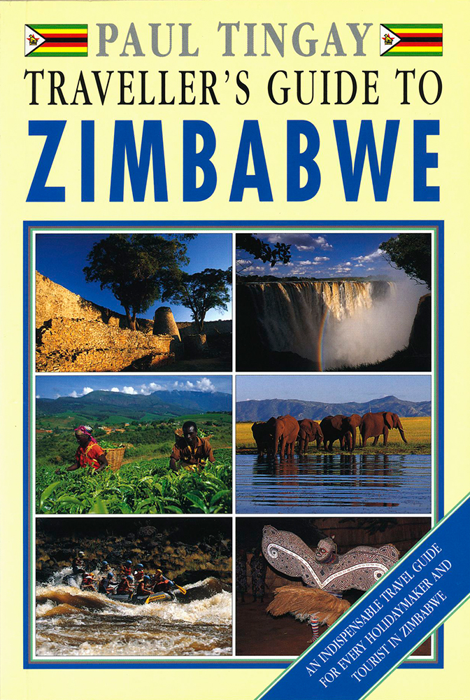
Zimbabwe, named after the largest ancient man-made structure south of the pyramids, Great Zimbabwe, is synonymous with the Victoria Falls and the inland sea of Lake Kariba, the mighty Zambezi River, the vast tracts of game-rich wilderness and the great granite boulders of the Matobo Hills. Set on a high plateau 500km (311 miles) inland from the Indian Ocean, Zimbabwe is a woodland of tiny-leafed msasa trees, of tumbled rock formations, tobacco farms, gold mines and misty mountains. It averages eight hours of sun daily, but winter nights can be freezing. Its population of some 13 million is mainly Shona-speaking but most, due to 19th-century British colonization and massive expenditure on schooling since independence, are fluent English-speakers. Good air, rail and road routes link its game reserves and towns. Zimbabwe lies firmly between the Limpopo and Zambezi rivers in southern central Africa. Nearly as big as California and about three times the size of England, much of Zimbabwe lies 600m (1968ft) above sea level, while its central Highveld crescent, where the main towns, heavy engineering industries and commercial farms are sited, lies at 1 500m (4 921ft). This plateau, with its rich central ridge, or Great Dyke, of minerals, consists of a belt of woodland interspersed with maize, tobacco and cattle farms running southwest to northeast for 650km (404 miles). It is bordered by country that is not quite as high, descending through hot, baobab-covered Lowveld with its sugar plantations and game reserves, to the great river valleys that frame the country. Massive granite outcrops that look as if giants have been piling boulder on precarious boulder dot the landscape. About 30 000 of these house San (Bushman) paintings dating back to the time of Jesus Christ. In the west, the country beyond Bulawayo is an ancient granite wilderness, Kipling's 'great spaces washed by the sun'. This is the Matobo National Park, burial place of British imperialist and diamond magnate Cecil John Rhodes, who for a 100 years gave his name to the country. Nearby are the zimbabwes of Kame and Nale-tale, stone ruins in the tradition of Great Zimbabwe of which there are nearly 150 in the country. The west is also the site of the country's finest game reserve, Hwange, where generators pump water for the world's largest concentration of elephant. The Zambezi forms the country's northern border and gives it its most renowned attraction, the World Heritage Site of Victoria Falls, where explorer David Livingstone's bronze statue gazes stoically over the turbulent Devil's Cataract and a mile-wide splendour of water, spray and thunder. One of Africa's largest lakes, 282km-long (175 miles) Kariba, is also on the Zambezi. The flooding of the Zambezi Valley 35 years ago encouraged the growth of wide shores of torpedo grass and attracted great quantities of game, while its drowned forests and kapenta sardines ensured an explosion of the tigerfish population. Downstream from Kariba is the Zambezi's second World Heritage Site, the wild and remote Mana Pools National Park, a riverine forest of mountains, huge trees, hippo, more than 400 bird species, and nearly the entire range of Africa's wild animals. The Eastern Highlands, bordering Mozambique and covering the Nyanga, Bvumba and Chimanimani national parks, seem more like Scotland than Africa. Rolling moorland covered with ferns, forests, coffee farms and trout lakes stretch for 300km (190 miles) and rise as high as 2 593m (8 508ft) at wind-buffeted Inyangani, the country's highest massif. Although Zimbabwe can still be terribly British with Barclays Bank, Parliament, polite policemen and business suits, it is also vibrant Africa where women dress colourfully, the music pulsates and the climate is near perfect. Every modern convenience is available, from wide-body jets, metal roads and automated cash dispensers, to British Sunday papers, American popcorn and elegant shopping malls. [...]
This is an excerpt from: Traveller's Guide to Zimbabwe, by Paul Tingay.
Title: Traveller's Guide to Zimbabwe
Author: Paul Tingay
Genre: Travel Guide
Publisher: Struik Publishers
Cape Town, South Africa 1996
ISBN 1868258335 / ISBN 1-86825-833-5
ISBN 9781868258338 / ISBN 978-1-86825-833-8
Softcover, 15 x 22 cm, 192 pages, throughout colour photos
Tingay, Paul im Namibiana-Buchangebot
Traveller's Guide to Zimbabwe
This nicely made travel guide to Zimbabwe dates from 1996 and is an antiquariatic collector's item.