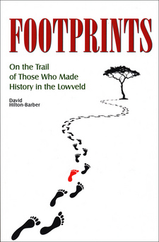
Footprints: On the Trail of Those Who Made History in the Lowveld, by David Hilton-Barber

Footprints: On the Trail of Those Who Made History in the Lowveld, by David Hilton-Barber. 30° South Publishers (Pty) Ltd., Johannesburg, South Africa 2016. ISBN 9780994656117 / ISBN 978-0-9946561-1-7
The following text from the chapter "The Lure of the Lowveld" represents style and content of David Hilton-Barber's book Footprints: On the Trail of Those Who Made History in the Lowveld.
The mountains we had crossed now loomed high above us, and Sheba's breasts were modestly veiled in diaphanous wreaths of mist. As we went on the country grew more and more lovely. Then vegetation was luxuriant; the sun was bright and warm, but not burning, and a gracious breeze blew softly along the slopes of the mountains. And indeed in beauty, in natural wealth, and in climate I have never seen its like. H. Rider Haggard: King Solomon's Mines, Mountains, valleys, waterfalls and splendid vistas characterise the escarpment. The Long Tom Pass is a spectacular route from Lydenburg up to the crest of the plateau, then down, following the old coach and wagon route. In the valley of the Blyde River can be seen the first of the towering cliffs, girt with thick forests at foot and crest. Across the valley the road runs on to Graskop and to the rim of the next and even grander series of cliffs. The view from God's Window, a few kilometres farther, looks out over one of the country's most majestic views. Far below, a thickly-woven green carpet of state-owned forests rolls away into the hazy distance, to the Lowveld proper and to the far horizon of the Lebombo Mountains. Many upland streams work their way down the escarpment, feeding rivers such as the Blyde, the Treur, the Letaba, the Steelpoort and the Spekboom, all leading into the Olifants River. The Olifants emerges from the region to the north, joining the Limpopo on its course to the sea. South of Lydenburg, the Crocodile and Komati Rivers also wind their way to the Indian Ocean but farther south, near Maputo. Farther north the Broederstroom River, near its source in the Wolkberg Mountains, once flowed into the Mohlapitse Valley and wound its way down to link up with the Olifants. Then occurred an amazing act of ancient piracy—millions of years ago the Letaba eroded backwards through the hills and captured the headwaters of the Mohlapitse. This is one of nature's mysteries. Mohlapitse's huge canyon carved into the Wolkberg bears evidence of the mighty waterway it once was. This would have bypassed what are today the fertile valleys of subtropical orchards. Instead, the source of the Mohlapitse is now a somewhat soggy and confused area, which has since been turned into a dam with a dam wall at each end. The old river now starts only from this point and, apart from occasional floods, only a small stream now flows along this once giant watercourse. Then there are the waterfalls. Some tumble down the open mountainside, others are hidden away in the cool and secret depths of the forests. They range from the Sabie Falls through the Lisbon and Berlin Falls, to perhaps the most spectacular of all, the magnificent double waterfall of Mac Mac, plummeting a dizzying 65 metres into the shadowed gorge below. Around almost every waterfall a mantle of mosses, ferns and ancient cycads clothes the area of the splash zone. Dense growths of indigenous trees and bush cluster around and overhang the cascades, their undergrowth alive with small birds, animals and insects. [...]
This is an excerpt from the book Footprints: On the Trail of Those Who Made History in the Lowveld, by David Hilton-Davis.
Title: Footprints
Subtitle: On the Trail of Those Who Made History in the Lowveld
Authors: David Hilton-Barber
Genre: Region History
Publisher: 30° South Publishers (Pty) Ltd.
Johannesburg, South Africa 2016
ISBN 9780994656117 / ISBN 978-0-9946561-1-7
Softcover, 15 x 23 cm, 256 pages, 200 colour & b/w photos, sketches, map, English text
