Cederberg Rock Art: Cederberg Conservancy and Eastern Koue Bokkeveld, by Peter Slingsby

Cederberg Rock Art: Cederberg Conservancy and Eastern Koue Bokkeveld, by Peter Slingsby. Baardskeerder cc. Series: Rock Art of the Western Cape, Book 3. ISBN 1919900578 / ISBN 1-919900-57-8

Images from Peter Slingsby's guide Cederberg Rock Art: Cederberg Conservancy and Eastern Koue Bokkeveld.
To anyone going to the Clanwilliam area a trip out to see the rock art described in this book, Cederberg Rock Art. Cederberg Conservancy and Eastern Koue Bokkeveld by Peter Slingsby, is a must. Taking along the book makes the paintings that much easier to find and the background info is very informative.
Example: Sandrivier
The Houdenbek Guest Cottage at Sandrivier is a beautifully restored historical monument, the early 19th century barn of the original farm. It has two sections, both self-catering: a "luxury" flat for up to two couples, and a very comfortable group section. At least two panels of interesting paintings are within easy walking distance of the Guest Cottage. Access to the paintings is with the farmer's permission only. A magnificent walk to the Heiveld Arch starts here; permits are obtained at the farm house.
Site One: is about a kilometre from Houdenbek along the tarred road towards Op die Berg. Follow the road away from the farm, past the first massive rocks on the right, until you reach a large solitary pine tree standing on the left of the road. On the right a track leads off into the veld, below a low rocky outcrop. About 100 metres from the main road there is a narrow shelf in the outcrop, and some interesting paintings above it. This may have been a habitable site, where the people camped in the veld around the outcrop.
Site Two: Walk or drive up past the farm shop to the dam. Follow the Heiveld trail for about 200 metres up the first kloof; the paintings are marked, in a shallow overhang on the left. The subject matter and situation strongly suggest that this was a shaman site. There has been some graffiti damage. [the following descriptions belong to images that we display here on our website] The large figure in the centre of the rock wall is peculiar in that it appears to have both feminine characteristics (a possible breast; possibly carrying a baby) and masculine. The very short legs and unknown black object around the waist are unusual. The apparent bisexual nature of the figure seems to be echoed in the small figure standing above the running leg of the hookhead figure to the right. There are its two very clear entoptics at this site. One is more difficult to notice at first: it seems to be just a few scratched lines. If you look carefully you will see that these have been painted. The second entoptic is a dramatic example of zig-zag, lightning-like lines of power; the strength in the image is extraordinary. [...]
This is an excerpt from Cederberg Rock Art: Cederberg Conservancy and Eastern Koue Bokkeveld, by Peter Slingsby.
Title: Cederberg Rock Art
Subtitle: Cederberg Conservancy and Eastern Koue Bokkeveld
Author: Peter Slingsby
Publisher: Baardskeerder cc
Series: Rock Art of the Western Cape, Book 3
ISBN 1919900578 / ISBN 1-919900-57-8 (South Africa)
3rd edition, Cape Town 2002
Softcover, 15 x 21 cm, 48 pages, monochrome illustrations
Slingsby, Peter im Namibiana-Buchangebot
Cederberg Rock Art: Cederberg Conservancy and Eastern Koue Bokkeveld
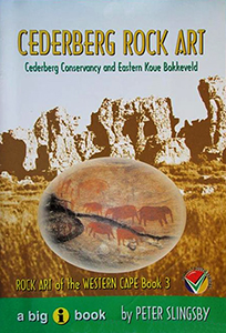
Guide No 3 to the rock art of the Western Cape focusses on the Cederberg rock art, Cederberg Conservancy and Eastern Koue Bokkeveld.
Rock Art of the Western Cape: The Sevilla Trail & Travellers Rest
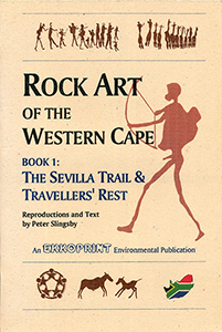
Guides to the rock art of the Western Cape via Sevilla Trail and Traveller's Rest, comprehensive notes with accurate colour reproductions.
Slingsby's Simon’s Town Karte / map - Fish Hoek Kommetjie 1:20.000
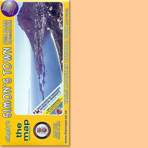
Karte der Region Fish Hoek - Simon’s Town im Süden der Kaphalbinsel
Table Mountain Map/ Karte 1:20.000 (Slingsby's)
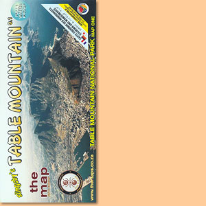
Einer der schönsten Tafelberg-Karten; one of the most attractive Tafelberg maps
Western Cape: Slingsby's walks with a fat dog and more walks without
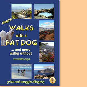
Western Cape: Slingsby's walks with a fat dog and more walks without consists of more than 60 descriptions of walks in the Western Cape, with 50 maps and over 500 photographs.
Beyond the Cederberg
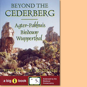
Beyond the Cederberg is a comprehensive guide to the Agter-Pakhuis area, its people, its facilities and its attractions for tourists.
Beard Shaver’s Bush. Place Names in the Cape
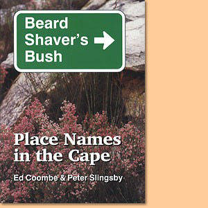
Beard Shaver’s Bush is a hilarious, informative and hugely entertaining guide to Place Names in the Cape.
Fynbos Road Karte/ Map. Explore the Agulhas Plain (Slingsby's)
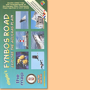
Developed with inputs from more than 40 prominent and knowledgable local residents
Garden Route Karte/ Map. Mossel Bay to Storms River (Slingsby's)
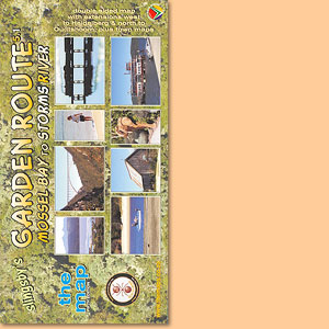
The new Fifth Edition continues the tradition, of accurate, comprehensive information
Bavianskloof Mega-Reserve Map/ Karte (Slingsby's)
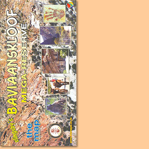
Most comprehensive, fully researched and detailed map of the Baviaanskloof
Cape Peninsula & Cape Town's Southern Suburbs Map/ Karte (Slingsby's)
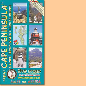
Slingsby's Cape Peninsula & Cape Town's Southern Suburbs Map also depicts informal settlement areas and a inset of Robben Island.
Overberg Whale Coast Map/ Karte. Hermanus, Cape Agulhas, Swellendam (Slingsby's)
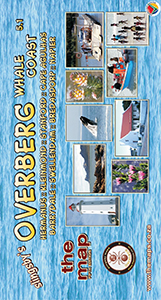
Dies ist Peter Slingsbys Overberg Whale Coast Map mit Unterkarten von. Hermanus, Cape Agulhas, Swellendam und zahlreichen anderen Orten der Region.
Cape Winelands Map/ Karte. Stellenbosch, Franschhoek, Helderberg (Slingsby's)
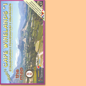
The first map in a series that will eventually detail all the winelands of the Cape
Day Drives From Cape Town Map/ Karte (Slingsby's)
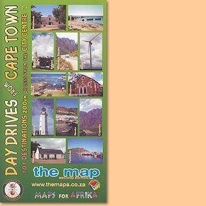
101 day drive destinations within a distance of max. 200 km from the city centre of Cape Town, a great Peter Slingsby map.
Wild Coast. East London, Port St Johns, Port Edward Map/ Karte (Slingsby's)
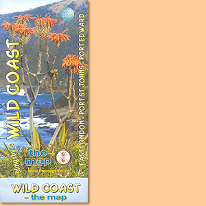
This map features the great 300km sweep of the Transkei Wild Coast, from East London to Port Edward.